
A number of people from a local neighborhood in Shoreview attended an open house in Fall 2021 with Ramsey County Traffic Engineers to express their concerns that the widening of the road and additional lanes would make it even more dangerous and difficult to cross than it already is. They stated that they felt rebuffed and their safety concerns ignored by the Ramsey County Traffic Engineers.
—–
Ramsey County, in conjunction with the cities of Shoreview and Vadnais Heights are redoing Hodgson Road between Gramsie and Hiway 96.
Project Website: https://www.ramseycounty.us/residents/roads-transportation/future-road-projects/future-road-construction-projects/hodgson-road-reconstruction
Stated Purposes are:
- Improve pedestrian and bike access
- Replace the aging pavement
- Improve stormwater management
All well and good. And the current proposed design (July 2021) is indeed, in some ways, somewhat of an improvement over the current roadway for people walking, riding bicycles and people with disabilities using mobility devices. However, that’s like an abusive husband saying that he’s only going to beat his wife 4 times next month instead of 5 – better, but good enough?
This design is ostensibly an improvement but is still far more dangerous and less useable than what other developed countries have been building as standard for decades and this design makes crossing much more dangerous than it is today.
Some additional information sources on why European roads are so much safer designed than U.S.
- https://streets.mn/2019/07/08/designing-a-road-different-cultural-perspectives/
- https://bicycledutch.wordpress.com
- http://www.modacitylife.com
- https://streets.mn/2014/03/25/why-are-we-letting-drivers-kill-our-children/
- https://streets.mn/2014/08/27/cycleway-fundamentals-safety-momentum-comfort/
For an more brief abridged version of the following: Hodgson Rd – Anatomy Of A Dangerous Road Design – Abridged
Table of Contents
- Why This Is Important
- The Design
- Engineering
- Concrete Enforces Better Than Paint or Paper
- The Fundamental Problem – Classification Creep and Engineered Conflict
- Induced Demand
- Specific Problems
- Junctions
- Roundabout
- Comparisons
- Conclusion
Why This Is Important?
The U.S. currently has the most dangerous road system of all developed countries.

Importantly, since this chart was created in 2014, fatalities in the U.S. have increased while those in many other countries have decreased.
Walking is more difficult to measure but is similar with some estimates that someone in the U.S., for each mile they walk, is about 17 times as likely to be killed by a driver as someone in Europe on average and 23 times more likely than someone in The Netherlands.
In just 2021 alone Minnesota drivers killed 497 people and seriously injured 1,922. Many of those seriously injured are in wheelchairs for the rest of their lives or are missing arms, legs or fingers. If our roads were designed as safe as The Netherlands then 392 of those dead people (sons, daughters, mothers, fathers, friends…) would still be alive and healthy today and fewer than 100 people would have severe injuries.

Sadly, deaths on our roads have continued to rise since that 2014 tweet and drivers now kill over 38,000 (oops, 42,915 in 2021) people each year.
This plan for Hodgson is a continuation of the thinking processes that have given us such dangerous roads.
Chilling Effect On Improving Health & Academics
Perhaps more important than the number of people killed or seriously injured is the chilling effect this and similar designs have on school children and adults choosing to walk or bicycle.
Safe Routes To School programs in the U.S. must have special days, typically two per year, when they mobilize enough law enforcement and parents to watch crossings to make it safe for children to walk to school. On roads designed by Dutch, Swedish and other engineers children safely walk or bicycle to school every day.
Are roads designed by U.S. engineers now considered so dangerous that parents who allow their children to use them are being charged with child abuse ?
Children who walk or bicycle to school perform better and are less stressed than those who come by car or bus. They have a better attention span and are about a half year ahead of others. They are healthier, happier and better behaved. This is a key reason why European and other countries are prioritizing making it so that ALL children can safely bicycle to school. The charge is often led by wealthier parents who recognize the benefits and want them for their children – they recognize the benefit to their children, shouldn’t ALL children in the U.S. have this benefit?
Moundsview and White Bear Schools spend about 9% of their budget on transporting children to school. We are spending 9% of our school system budget to make our children less healthy and less academically successful. What if that 9%, $13m/yr for Moundsview, was instead spent on …teaching (or not raising another levy)?
Some of the highest concentrations of air pollution are around schools. This compliments of cars and buses lined up spewing exhaust while waiting to drop off or pick up students. There is a high correlation between air quality and academic performance and this carries over in to future career options.
A doctor visiting a local school and noting the line up of cars said that if he stood there smoking and blowing second hand smoke in to children’s faces that all of the parents sitting in their idling cars would blow a gasket. Yet they are actually causing greater harm to these children.
The Netherlands has near zero school buses. 62% of children now bicycle to school, 29% walk and 8% come by car. Other countries in Europe and Asia have this same goal and are close behind. There is also evidence that walking/biking to school lowers the prevalence of ADHD in some or many children.
The U.S. is currently ranked 24th of 27 nations for academic performance and our worst in the developed world student health is a key factor.
We have the least healthy overall population of developed countries and among the lowest life expectancy. Interestingly, there is a very high correlation between bicycling for transportation and health – countries with higher rates of transportation bicycling have a healthier population and countries with low levels have the poorest health. We are last. U.S. traffic engineers make bicycling dangerous and unappealing so people understandably won’t do it and our health suffers.
We are supposed to be a great nation. Why can’t our engineers design a road system as safe and well functioning as engineers elsewhere? Why is a child riding a bicycle in the U.S. 11x as likely to be killed on roads designed by U.S. traffic engineers as those designed by EU engineers? Why must our children endure lengthy bus rides while children elsewhere freely and safely bicycle to school?
The Design
The current roadway includes two 12’ travel lanes in 40’ of pavement.
The new design adds a center turn lane, 2’ of additional contiguous pavement, a walkway and a multi-use trail.

Traffic Engineering
Frequently in engineering, attempts at improvement involve a lot of theory and experimentation – going where no human has gone before. Here it is very different – others have led the way for us. There is no need for theory or experimentation. We need only look to how others, primarily The Netherlands and Sweden, have achieved much safer roads and many fewer people killed or seriously injured and then simply do what they’ve done.
There are reasons why other countries have so many fewer people killed on their roads than we do and why so many are killed on our roads. Most of these reasons relate to how our traffic engineers design our roads.
The gold standard for safe design, the design guide that produces the safest roadways, particularly for the most vulnerable; people walking, bicycling or with disabilities, are the CROW manuals that are the foundation for safer road design used in The Netherlands and increasingly elsewhere.
In a quick review there are at least 33 elements of this new design for Hodgson that violate basic CROW design principles and make this plan unsafe. It’s important to note also that engineers in Europe consider the CROW standards as minimums for safety and often design roads to a stricter/higher safety standard.
Safer does not mean slower travel times for drivers. Safer is primarily about driver attention and protection of the most vulnerable through separation.
Melissa Bruntlett points out “The Dutch have a saying: Beter goed gestolen dan slecht uitgevonden (“Better well stolen than badly invented”)”. U.S. and Ramsey County engineers need to rid themselves of their Not-Invented-Here syndrome and provide us with safer road designs.
Concrete Enforces Better Than Paint, Paper or Plastic
U.S. Traffic Engineers assume every driver will always perfectly obey every rule and design roads for safety to be enforced by law enforcement – issuing paper tickets. And this might work if we had a cop on every corner insuring that drivers, bicycle riders, people with disabilities and people walking all obeyed every law and always acted safely. If cops were always present to insure that people didn’t drive too fast, were always paying attention to the road, looked before crossing a bikeway or entering a junction, and never veered over a painted line or plastic flexi stick on to a shoulder, bike lane or refuge where someone is bicycling or standing.
Labore Rd in Little Canada is signed for 30 MPH – it’s a residential street. But like this design for Hodgson it is designed for 70 MPH with 11’ wide lanes in 32’ of pavement. Not surprisingly many people drive 50-60 MPH on Labore. When asked, a traffic engineer stated that “speeding is a law enforcement problem”.
EU Engineers expect that drivers will make mistakes or want to intentionally do stupid things and design roads to self-enforce safety as much as possible – no cops necessary. Narrower lanes and pavement, curbed and barrier protected refuge islands, chicanes, tighter radius corners and other elements that CAUSE drivers to pay close attention and drive with caution. Dutch engineers say that people speeding, needing a stop sign or even just someone feeling the need to put out a little flag person statue is a sign of engineering failure.
This is why The Netherlands is on the safe end of that chart above and we are on the opposite how-many-people-can-our-road-designs-kill end.
There’s a deeper element at work as well and that is how our road designs contribute to teaching our children to be criminals.
The Fundamental Problem – Classification Creep and Engineered Conflict
The biggest issue with this plan is at another fundamental level. This section of Hodgson has numerous residential road junctions and driveways. It has a lot of people leaving and entering the roadway at many different places and a lot of people needing to cross the roadway. Further north is a school that many children walk/bicycle to. It is, in traffic engineering speak, High Access or High Exchange. These are not changeable characteristics. (This proposed design also results in a 3-lane, 45+ MPH throughway within less than 50’ of people’s homes).
Ramsey County however have classified this as an Arterial road. Arterial roads, like Hiway 96 that intersects Hodgson on the north end of this project, are for higher volumes of traffic, higher speed traffic, low delay and limited and controlled exchange/access (few junctions, crossings or driveways). For drivers an arterial through road is a low attention needed roadway.
Here is how MNDOT summarizes these classifications.

By their nature, due to the higher speeds and limited delay expectation of drivers, the junctions on a Arterial need to be controlled with traffic signals or roundabouts. To be safe, crossings need to be at controlled junctions or be grade separated (tunnel or bridge). People driving on an arterial road between controlled junctions are not expecting nor looking for people walking, bicycling, in a wheelchair, on a mobility scooter or driving to be entering or crossing the roadway. The road design makes it feel limited access and people will drive on it like it’s limited access. In driver’s minds they and they alone own the road until they get to the next controlled junction.
So Ramsey County are creating a conflict. They are taking a roadway that is unavoidably High Access, and trying to treat it like a road that is Limited Access, but without the protections of Limited Access – This is Classification Creep. In this case to allow them to add the center turn lane for more through traffic speed and volume.
Given driver expectations a junction or crossing for an Arterial needs to be controlled. But you can’t do that as frequently as necessary along Hodgson because of the high number of junctions, crossings and driveways. This creates high conflict. And greater danger for anyone entering or crossing Hodgson.
Another problem with classification creep is for people entering from roads and driveways (private and public) connected to the creeped roadway. It is best to have Driveways, Retail Access Streets and Residential Access Streets connect only to lower speed and lower traffic volume Collector type roads for safer and smoother flow of traffic. When a Collector is made to be more of an Arterial then accessing it from side streets and driveways, or crossing, becomes more difficult and more dangerous. This is because the higher speeds and traffic volumes need traffic lights or roundabouts for safe exchange of traffic.
For more see: Reclaiming Our Residential Streets
Induced Demand
On top of the immediate safety issues, when a roadway is made to have less delay and higher speeds, when it becomes more arterial like as is this plan with Hodgson, then more drivers will choose to use it more often as a thru route from/to more distant places rather than taking a more appropriate route to their destination. This is called Induced Demand. The problems include:
- Increased volume of traffic – More people choosing to drive through here than would otherwise.
- Less desirable drivers – People on a through route may drive faster and more aggressively with less attention and less consideration for others than a local resident.
- Increased Risk for Pedestrians and Bicycle Riders – Increase traffic volume and driver expectations of this being limited access make crossing more difficult and more dangerous.
- Negating of Other Benefits – For local drivers the increased thru traffic can reduce any potential benefits of things like adding the center left turn lane. It does however lessen traffic on other routes that are more appropriate for thru traffic such as 96, 35W and 35E. Treating this as a Collector would likely decrease current traffic levels as drivers who currently use Hodgson as a thru route choose 35E or 35W.
Anecdote: I frequently drive south on Hodgson towards St Paul or the airport. At hiway 96 I have a choice of continuing south on Hodgson or taking 96 east to 35E. Today I often choose 96 to 35E. If this plan is implemented I will likely always choose Hodgson instead. So I will be adding to the increased thru traffic on this section of Hodgson.
Similarly, people going to/from the new apartments on Hodgson and County Rd J. Via J to 35E they will encounter 11 public exchanges (side road entrances) and 54 private exchanges (residential driveways). Via Hodgson they will encounter 61 public exchanges and 101 private. Encouraging people to use Hodgson as this plan is intended to do results in 6x the conflicts at side roads and twice the conflicts with residential driveways. But there’s potentially a much greater difference as there are good options for reducing the number of public and private exchanges along J to make it a safer arterial while there are few or none along Hodgson.
Some Specific Problems
1a – Bi-Directional Trail / Bikeway – Dangerous
Bi-directional (or two-way) trails/bikeways work well when there are few crossings but are quite dangerous when there are many crossings such as there are along this section of Hodgson Rd.
The reason is that when a driver approaches a roadway from a side road or driveway they instinctively look to their left – for approaching cars that are a threat …to them. Drivers frequently do not look to their right for people walking or riding a bicycle and crossing in front of them as in this example (This is in the UK so is backwards to us but the principle is the same).
This is particularly dangerous in the U.S. as we still allow right-on-red which has largely been outlawed in other countries. And worse yet because drivers in the U.S. frequently do not stop or look both directions (as required by law) before turning right on red. There’s a similar risk at stop signed junctions and parking lot entrances with drivers not stopping or looking.
Even when drivers do look to their right, when making a left turn for example, they often only look to the far side traffic lane, for who is a threat to them, not to the near side bikeway/walkway.
There is also a problem of the glare from motor vehicle headlights blinding people walking or bicycling against nearby motor traffic. U.S. regulations allow a much higher and wider beam pattern than EU regulations and U.S. regulations also prevent the use of much better auto adjusting ADB systems. Even so, EU engineers try to keep two-way bikeways far from the road to help reduce glare. Bikeways in Europe are also usually well lit while those in the U.S. rarely have lighting.
Elsewhere bi-directional are used only where there are very few (perhaps 1-3 per mile) side road, parking lot or driveway entrances or when a bi-directional significantly reduces these crossings enough to make up for the increased risk at junctions.
1b – Bi-Directional Trail / Bikeway – Congestion
This is the same basic design as Hodgson Rd north of Hiway 96 with a walkway on one side and a multi-use trail (MUT) on the other. One difference is that the MUT in this plan is narrower, only 8’ wide, compared to the 10’ wide trail north of 96.
The current MUT north of Hiway 96 can get quite congested at times. There are three primary causes of this congestion; 1) bi-directional (or two-way) trails result in greater congestion because of reduced passing opportunities, 2) a multi-modal MUT creates greater congestion and requires more passing because of the extreme differences in speed between people walking at 3 MPH and bicycling at 12 MPH, and 3) simple capacity – squeezing all bicycle riders on to this one side.
Perhaps worse than the congestion itself is that some people will no longer bicycle or walk on the MUT north of 96 because of the congestion (and poor maintenance that’s resulted in bone jarring bumps).
A MUT on each side would be able to handle about 3-4x as many people as the current plan simply because single direction travel is much more efficient use of space.
And importantly, this area south of 96 has approx 5x as many people living in close proximity and who are likely to walk and bicycle along here when complete. So this area needs greater walking and bicycling capacity, not less.
So, narrower MUT/Bikeway, one more traffic lane and 5x as many people… What could go wrong?
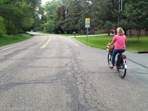
2a – Long Crossing Distances
Traffic engineers in safer countries try to keep unsignalized crossing distances to no more than 8-10’ (one lane) and a single direction of motor traffic at a time for busier roads like Hodgson and no more than 17-19’ (two lanes) for less busy side roads. Any crossing distance greater than 19’ generally requires stop lights at each crossing. Ramsey County are proposing unsignalized crossings of up to 107’.
There are several reasons that engineers elsewhere do this. One is time – it takes twice as long to cross 40’ as 20’ and so the person crossing is at risk for twice as long. Longer crossing distances also require a much larger gap in traffic and increase the likelihood of tripping both because of distance and because longer crossing encourage or require people to run rather than walk.
Perhaps most important though is that keeping crossing distances short also narrows the roadway. It signals to drivers ‘hey, something’s going on here so be careful’. Engineers will often narrow the width between cement curbs which causes drivers to pay much closer attention lest they damage their tires or rims on the curb. And while paying attention to not damaging their tires they also see people walking and riding bicycles.
The current design for Hodgson includes unsignalized crossings of Edgerton of over 100’ – ten times the distance most other countries consider safe or would allow. Some EU engineers said that they’d limit crossing Edgerton to 8.5-9’ curb to curb without a signal given the speeds and traffic volume. Or 9’ curb to curb and 11’ red to red by which she meant that there will be an 11’ gap from red path to red path so that people walking and bicycling know where it is safe to be since vehicle mirrors can protrude past the curb.
Below the white crossing is 107’ and 5 lanes of traffic. Someone crossing here will be at risk for about 1 minute and face threats from 4 different directions. The shorter crossing is 64’ and 3 lanes of traffic. Someone crossing here will be at risk for about 32 seconds and face risks from 4 different directions.

Here, even just moving the shorter crossing 15’ to the left (south on the actual road) and widening the island to 8-10’ to create a refuge could be a significant increase in safety. The first crossing, to the refuge island, would be 11’, take 5 seconds and threat would be from a single direction. The second crossing would be 22’, take about 11 seconds and threat would be from 3 directions.
Then do something similar for the longer crossing.
Crossings of Bridge Street, Snail Lake and others are often 50’ or greater – over twice the distance engineers in other countries would allow for such side street crossings.
Others achieve shorter and safer crossing distances with narrower travel lanes, not having crossings in the apex of a radius (e.g., they place them farther from the junction) and by including refuge islands.
Even at signalized junctions they try to keep crossing distances as short as possible, for safety, and because this reduces the time people are in a crossing and so increases the time that cars can drive through.
Also, mid-block crossings can be safer than at-junction crossings. For people crossing the threat is from one direction only versus from 3 directions at a junction. For drivers they need only watch for someone crossing vs having to simultaneously deal with numerous other issues at a junction. This is another reason why crossings at junctions are placed at least one car length or 14’ from the junction (vs directly next to the junction in the U.S.).
OSHA will not allow factory workers or airport employees to encounter something nearly as dangerous as proposed here yet Ramsey County thinks that it’s OK for a mom and child? Or for children alone?
2b – Crossings Too Close To Junctions
CROW calls for crossings to be placed about one car length (typically 14’) from the closest motor vehicle through traffic lane. Benefits include:
- Shorter crossing distance
- Drivers approaching the junction can safely see people in the crossing or about to cross because they are more directly in their field of view, stop for them, and then proceed to the junction. With Ramsey County’s design a driver is having to focus on numerous threats at the same time and most drivers are more focused on cars in the junction that are a threat to them rather than people in a crossing who are not a threat to them.
- More so for drivers exiting the junction.
- Provides a safe waiting space for drivers entering a junction. They deal with the crossing and THEN move forward and wait for a safe gap in motor traffic.
- Provides a safe waiting space for drivers exiting the junction. They deal with the junction and can then wait safely out of the way of through traffic.
- Provides safe waiting spaces for people walking and bicycling.
- Eliminates the congest that Ramsey County’s design causes of people from multiple directions trying to share a single small space.
More: https://bicycledutch.wordpress.com/2014/02/23/junction-design-in-the-netherlands/
2c – Sharks Teeth
Liberal use of Sharks Teeth clearly communicate to drivers, people walking, bicycling or with disabilities who has right-of-way. They eliminate ambiguity. If the sharp end of the teeth are pointing at you then you do not have right-of-way, should proceed with extra caution and must yield to crossing or conflicting traffic.

This also allows traffic engineers to safely give motor traffic the right-of-way when appropriate (as we’ll see in the next section).
3 – No Refuge Islands
Outside of the U.S. it is common to see refuge safety islands between motor lanes for people walking and bicycling. These Refuge Islands serve three critical safety purposes; 1) they shorten the crossing distance, 2) allow people to cross a single direction of motor traffic at a time, and 3) increase driver attention.

At Hodgson Rd and Cunningham Ln (above) one day recently I watched a mom and her child trying to cross Hodgson. It took 13 minutes before there was a break in traffic that allowed them to make the 73’ unmarked unprotected crossing. And they were not being extra cautious. Because of the bad road design they had to wait until they could make the entire 73’ trek at once. Any time there was a small break in traffic from one direction there’d be cars coming in the other. When they did cross they had to run which increases the likelihood of tripping, especially for children.
One point here is that this is a legal crossing. Cars in both directions are legally required to stop when someone is waiting to cross. But who knows that? I have never seen that happen though Ramsey County traffic engineers tell me that cars do stop.
As someone on Nextdoor pointed out, Ramsey County traffic engineers are forcing people, including children, to play Frogger with real cars going 50-60 MPH. That’s irresponsible. OSHA wouldn’t allow employees on a job site to encounter something as dangerous as Ramsey County engineers expect children to deal with.
Here is a crossing (below) built to safer CROW standards. Someone crossing here need only cross <10’ and one direction of <30 MPH traffic at a time. This crossing is in a Caution Zone – just before this is a speed bump with painted serrated bars that warns drivers to be extra cautious. Note too that bicycle riders (and people walking) have ‘sharks teeth’ which means that they must yield to motor traffic. Because they need only cross about 10’ and one direction at a time and there are relatively few people crossing here this is still safe and allows motor traffic to proceed cautiously without stopping.
If they begin getting complaints of it taking too long to cross then they will narrow the crossing (road width), install curbs on the outside and change priority so that cars must yield to people in the crossing.

The crossing above is in a caution zone as indicated by the serrated bars and speed bump (below).

You can see it coming from the other direction at about 1:40 in this video:
With a CROW design this mom and daughter would have first made an 8.5’ crossing of one lane of traffic in a marked and possibly raised/tabled crossing (with drivers paying close attention so that they don’t damage their tires). Then waited on a large protected refuge. Then made a second 8.5’ crossing. With a refuge island and slightly narrower lanes it would have taken them less than 30 seconds, walking instead of running, much safer and much less stress inducing.
Even just making the first crossing of northbound traffic 10’ to an island and then 20’ or even 30′ across the southbound lanes would be significantly safer simply by allowing them to cross one direction of traffic at a time and reducing the crossing distances by more than half. It would still not be considered safe or legal elsewhere but would be a huge improvement for us in Ramsey County.
Refuge Islands work well when a crossing distance would otherwise be greater than 19’ but traffic patterns don’t warrant a signal system or on two-lane roads when speeds are high such as Hodgson.
One engineer told me that they will never allow you to cross more than one narrow lane at a time without a signal on a road with 45 MPH traffic such as Hodgson – EVERY crossing of Hodgson would have either a refuge island, signal lights or both.
Ramsey County engineers say over 100’ for a mom and child dodging 45 MPH traffic is acceptable.
Engineers elsewhere also include refuge islands for many signalized junctions. Some countries now require them for any crossing greater than 88’ and engineers will also use them for crossings shorter than 88’ as it is safer and allows them to shorten the overall cycle times of the junction making the junction more efficient for all users.
Some key design elements of a refuge island include; 1) The refuge being at least 10’ wide to accommodate a bakfiets or bicycle with a child trailer. Wider than 10’ is better and safer, 2) Narrow curb to curb distances for travel lanes on each side to increase driver attention and 3) Clear sightlines for drivers and people crossing to see each other. Solid reinforced barriers such as concrete planters or bollards may be necessary for higher traffic volumes/speeds or in areas with challenging weather that can result in drivers loosing control.
4a – Unmarked Crossings
I believe the U.S. is the only developed country that allows unmarked crossings.
Every road junction in Ramsey County is a legal crossing. But who knows? Who thinks about that when they’re going 45-55 MPH up Hodgson?
Interestingly this is something that has generated the most comments from Dutch engineers even though not the most dangerous fault with this plan. And more interesting is that The Netherlands (and increasingly other countries) do not have laws against J-Walking – people can legally cross any street anywhere anytime.
4b – Bikeway & Walkway: Continuous Color, Material and Grade
A significant safety problem on Hodgson Rd north of Hiway 96, and this is a problem throughout Ramsey County, is that drivers are often unaware of the presence of a walkway or bikeway. There is little or nothing to indicate this to them. The result is dangerous conflicts when a bicycle rider suddenly appears in front of them. Combined with drivers having been encouraged to not stop and look when making right (and often left) turns on to Hodgson this is a quite dangerous scenario.
Insuring that drivers know very clearly when they are crossing a bikeway or walkway has proven critical to fewer deaths and safer streets elsewhere and has been standard for about 20-40 years. A key way that they do this is that bikeways and walkways are consistent in color, material and often grade through all driveway and minor street crossings. Bikeways elsewhere are often a muted red color that both blends in well with natural surroundings and alerts drivers to the presence of the bikeway. Anytime a driver sees this color they know that it is a bikeway and that there are likely to be bicycle riders or people with disabilities.

5 – No Walkway
Many countries will no longer allow multi-use trails in built-up areas. The speed differences between people walking (3 MPH avg) and bicycling (11 MPH avg) are too great. Along any road with a speed limit of greater than 18 MPH they will build a minimum of a 5’ walkway and 6.5’ bikeway on each side (an 8’ bikeway is standard unless there is no other option).
The disparities between people walking and bicycling are considerably worse when e-bikes are included as these have higher average speeds, greater torque and greater weight. A key element of road safety is separation by speed and mass which is grossly violated by forcing pedestrians and e-bikes to share space.
There is also an issue that Minnesota now (as of August 2021) allows much more powerful e-bikes on MUT’s like this one along Hodgson. And these new laws allow significantly more power on trails with pedestrians than Europe allows on bikeways with no pedestrians. Minnesota’s new law allows throttle-controlled e-bikes (effectively electric motorcycles) of speeds up to 20 MPH and pedal-assist e-bikes that provide power up to 28 MPH.
(On the pseudo good news front they now limit e-bikes to 750w (watts) rather than 1000w. However, consider that the average bicycle rider going 13 MPH is using about 70w so a 750w e-bike is still over 10x more powerful than an average bicycle rider.)
Europe has 3 classifications of e-bikes/mopeds; E-bikes are pedal-assist only and assist must taper to 0 at or below 15 MPH. E-bike riders may go faster than 15 MPH but only without electric assist. Any electric assist above 15 MPH makes it a Heavy Moped. Light Mopeds allow throttles but speeds are limited to 15 MPH, the moped must have a license plate (blue) and the rider must be licensed and insured. Heavy Mopeds allow throttles and speeds up to 28 MPH, must have a license plate (yellow) and the rider must be licensed, insured and wear a helmet.
In built-up areas (such as this section of Hodgson) Europe generally only allows e-bikes (pedal-assist only and that tapers to 0 at 15 MPH or lower). And this is for bikeways with no pedestrians.
Light Mopeds are allowed on some bikeways and not on others though cities are increasingly forbidding them due to their higher rate of crashes and more severe injuries. Heavy Mopeds are allowed on some rural bikeways.
Something that’s very noticeable in Europe is that the more power of their own that a rider provides the safer and more respectful they are of others. And conversely the less power they provide and the more provided by a motor the less safe and respectful of others the riders are. Because of this and higher rates of crashes and more severe injuries with e-bikes the rules are being reviewed.
6 – 8’ Trail Width
The widely recognized standard width across all developed countries for a one-way protected bikeway is a minimum of 6.5’ or 2m. For two-way bicycle traffic this minimum increases to 8’ or 2.5m. These are both assuming a 10” buffer to the roadway curb (or 20” buffer if roadway speeds exceed 25 MPH and 60” if 45 or greater) as well as a 10” buffer to the adjacent walkway.
Here standards diverge. Guidelines in many countries, including the U.S. and Minnesota say that a mixed use trail such as this must then be a minimum of 3m (10’) to account for the differing speeds and mass of bicycle riders and pedestrians.
An increasing number of countries however no longer allow multi-use trails at all in built up areas. They now require a separate protected bikeway and walkway on each side with a minimum bikeway of 6.5’ and a minimum walkway of 4’ with at least 10” of buffer between them. This requires only about 1’ additional space vs a 10’ MUT but results in a much safer and less stressful design.
Importantly, all of these minimums are frequently exceeded as engineers find them to be too narrow in practice. Whenever possible they design wider bikeways and walkways. Several engineers have told me that they rarely or never design a bikeway of less than 8’ partially because even one-way bikeways will have some people going in the opposite direction for short bits to reach their destination.
For comparison the MUT north of 96 is 10’ wide and even with about 1/5 the population density of the area south of 96 results in considerable congestion at times. This MUT also has problems of bushes not being cut back from the path resulting in a useable width of sometimes less than 4′ (other countries generally keep brush about 2’ back from the path so that users may always safely use the entire width of the path).
7 – Wide Radius Corners
Road designs elsewhere use tighter radii in corners. This forces drivers to pay closer attention and to slow down slightly when turning.
8 – Lane Widths & Pavement Width
Engineers elsewhere have long known that narrower motor vehicle lanes result in safer roads. This because drivers pay better attention on narrow lanes and pay less attention when in wider lanes.
This same holds true for overall pavement width. The more contiguous pavement (e.g., pavement between curbs or grass) the less drivers pay attention because they feel like they have a lot of room for error.
Greater width of contiguous pavement increases noise since it increases the amount of noise reflected rather than absorbed. Greater width needs a larger grass/vegetation space between the roadway and bikeway to pile snow.
While this design has 42’ of contiguous pavement at it’s narrowest, in safer countries this would be about 19’ curb to curb. Not only would it be safer but also much quieter for people who live along this road or who are walking or bicycling.
Narrower lanes also allow for more grass, trees and other vegetation.
9 – Center Left Turn Lane
The purpose for this extra lane is to reduce delay experienced by drivers waiting on other drivers to make left turns. Sounds good.
Engineers in safer countries know this very differently – these delays, typically 2-5 seconds, serve some critical purposes to increase safety.
- Driver Attention. These brief delays reduce driver expectation of this being a free/continuous flowing high speed through road, increase driver expectations of needing to slow or stop and so increase driver attention. Making this more free flowing with the addition of a continuous center turn lane increases driver expectation of non-blocking freeway like driving, decreases driver attention and increases driver impatience and aggression. And for Engineers elsewhere this is a road-system-wide issue. They do not want drivers to develop an expectation of surface streets (vs divided highways) being continuous flow and freeway like. They want drivers to distinguish in their mind between a high speed divided highway and a lower speed roadway that requires much greater care.
- Access Safety. Cars stopping to turn create gaps in traffic that allow others to more safely enter the flow of traffic. Without these gaps being created the traffic flow becomes high speed and constant which makes it more difficult (sometimes nearly impossible) and much more dangerous for people entering from side streets or driveways.
- Crossing Safety. Cars stopping to turn create gaps for people crossing. Similar to above, without these gaps it can be more difficult and dangerous to cross. In my example above with the mom and daughter trying to cross – they were only able to cross when they did because of such a gap created by a turning car.
- Traffic Volume and Driver Aggression. Cars stopping to turn encourage non-local traffic to use more appropriate alternate routes. If Hodgson is known as a more free flowing arterial road rather than a local collector type road then more people will choose it as a through road. There are two problems with this. First is simply the increased volume of traffic. Second is that these are drivers who are mid-commute and who live farther away rather than local people at the beginning or nearing the end of their commute. The latter are likely to be less aggressive and more patient.
This lane design increases overall contiguous pavement width which also reduces driver attention, increases speeds and increases noise. Engineers in safer countries try to use as little pavement as possible for better driver attention and less noise.
Engineers elsewhere will use left turn lanes to reduce delay but only where critically necessary. They will also have specific lanes for specific turns rather than a single long shared lane, they usually also introduce a forced chicane to slow drivers down. They have a higher threshold for when they’d include them – the volume of traffic on Hodgson does not appear meet any of those thresholds.
Additional lanes make crossings longer and more dangerous for people walking or riding bicycles. For a traffic engineer in Europe with their focus on safety for the most vulnerable road users this will also require an extra refuge or the addition of signal lights at crossings and junctions.
U.S. engineers will say that this takes pressure off of drivers making left turns so they are more likely to wait for people walking or bicycling. Reality is that this doesn’t actually happen so much with an open lane as designed. For this to work requires cement curbed chicanes that force drivers to slow down.
The extra contiguous pavement increases noise for those who live along the road or who are walking or bicycling along the road. Tire and wind noise reflects off of concrete and asphalt but is largely absorbed by grass or vegetation. Contiguous or continuous pavement is worse because this noise reflectance is exponential with the amount of continuous pavement so even a small bit of vegetation that breaks up the continuousness of the pavement helps to reduce noise significantly. This is a more critical issue in the U.S. because unlike other developed countries we do not require lower noise tires nor do we very often use surfacing techniques on roadways to reduce noise.
Perhaps the bigger issue here though is that adding this center turn lane reduces bicycling and walking facilities. Ramsey County engineers have stated that they cannot do a wider MUT (and must build one 2’ narrower than state guidelines) nor a walkway on each side nor a proper bikeway + walkway on each side BECAUSE of the 12’ used by the addition of the center turn lane.
So while they state that this project is “to improve pedestrian and bike access”, and they have indeed done that, they are also making the roadway overall less safe.
This lane also results in the motor travel lanes being 6’ closer to homes on either side.
A Swedish engineer told me: “You make the motor vehicle lanes more dangerous, increase noise, decrease walking and bicycling facilities and decrease vegetation – Why would you do this?”
10 – Speed
Speed is actually not a very critical safety element here. A lower speed would be good and in safer countries this would likely be 37 MPH (60 Km/H) but simply decreasing the speed would not make this design much safer and one engineer told me that the primary reason they’d use a lower speed is noise, not safety.
Far more important than speed is driver attention. This design encourages drivers to NOT pay attention. The 42’ of wide contiguous pavement (and much wider at most junctions and crossings) tells drivers that they can drive faster and pay less attention because there’s A LOT OF ROOM FOR ERROR. So it’s OK to look at your phone or fix your hair in the mirror or look at the person next to you or look at the person walking along the path or look anywhere but at the road because – There’s a lot of room for error. And, you don’t have to worry about cars slowing or stopping in front of you – this is a non-blocking freeway like experience.
And where driver attention is most important is anywhere they interact with people who are less vulnerable – crossings. This is why outside of the U.S. crossings are made very prominent.
One other point. At the roundabout for instance, the primary problem and the reason underpasses are critical is the volume of cars, not so much the speed. Only if the volume of cars was much lower would speed become a factor. But whether motor traffic is going 50 or 30, if there is no gap in traffic there is no gap in traffic.
Junctions
There are a number of elements of junctions (roundabouts, intersections, side road entrances and sometimes high traffic driveway entrances) in Europe that make them safer than those in the U.S.
Aside from crossing distances being much shorter they also usually place the crossings farther back from the junction. This has several critical advantages;
- Cars/drivers are perpendicular to the crossing and more able to see someone in the crossing or about to cross.
- Cars are going much slower after they turn than they are when encountering a crossing in Ramsey County that is at the beginning of a turn.
- There is sufficient room for a car or small truck to stop before the crossing and also be out of the way of traffic behind them.
- Reduces bicycle rider and pedestrian congestion as a waiting area serves one crossing direction only vs Ramsey County crossings that serve two crossings in two different directions. For example, this is a frequent problem in the NW corner of Hodgson and Village Center Dr when people are waiting to go south across Village Center Dr and blocking the bikeway for people crossing Hodgson so the people crossing must stop and on numerous occasions drivers waiting to turn right on to Village Center Drive did not expect them to stop and began going and nearly hitting (or in one case that I know of did hit) people.
For more:
Roundabout
Roundabouts are safer for people in cars than intersections and they can be safer for people walking and bicycling.
Ramsey County have done some good things with this roundabout from a walking and bicycling standpoint. The crossings are set back from the roundabout and they’ve included refuge islands. For a lower volume and lower speed roundabout these, perhaps along with some sharks teeth to indicate ROW, shorter crossing distances and tighter geometry plus reverse camber to slow drivers, would be sufficient to make this a safe roundabout.
However, the traffic volume, entrance/exit speeds and overall design speed of this roundabout are too high for surface crossings. In countries with safer road systems this roundabout would have underpasses for people walking and bicycling.
And these underpasses are in countries where drivers nearly always, perhaps 99.9% of the time, stop for people in marked crossings. Stopping percentages are much lower in the U.S. and in Ramsey County. In testing this at a roundabout further south on Rice Street I found that only 3% of cars stop for someone in a crossing. 97% DID NOT stop.
The minor problem is crossing traffic that is entering the roundabout where you need only be concerned about cars from one direction and these cars are actively slowing down to enter the roundabout.
The major problem is crossing motor traffic that is exiting the roundabout. Here you must watch for traffic from EVERY arm of the roundabout. With a roundabout you do not know what car or truck will be exiting where you want to cross so you must consider that EVERY one of them will want to exit where you want to cross and so EVERY one is a threat.
In The Netherlands I can make surface crossings at most roundabouts without worrying much about cars because I know that they will stop (if I have right-of-way which is often the case). Drivers in The Netherlands (and largely throughout Europe) know that they may need to yield to someone in a crossing on exit and so they are prepared for it. That’s not the case here in Ramsey County so to cross safely I have to wait until there are no cars in the roundabout nor close to entering any other arm.
This might not be a problem during some parts of the day but during morning and evening rush and somewhat at other times this can be a challenge. It can easily take 10–30 minutes until it’s safe to cross.
That’s a long time to wait and especially for a child riding 10 minutes to school. So people begin taking risks and crossing when it’s ‘almost safe’. Most of the time this works OK. Some of the time a car not prepared to stop does, which is good, but then the car too close behind them not prepared to stop slams in to them. And sometimes the car does not stop and someone ends up dead.
So this is a roundabout that would be only nominally safe with Dutch drivers and even so many or most traffic engineers there would not use surface crossings. How save is this with U.S.drivers?
Comparisons
Following are comparisons of Existing, Proposed and CROW stacked for comparison. CROW is how this road would be built in Europe given function and volume. House setbacks along Hodgson vary – this is using an approximate average. (yes, one lane is going in the wrong direction – an occasional abnormality of this app).
The proposed roadway places motor travel lanes about 6’ closer to houses on each side than the existing roadway. This plus extra contiguous asphalt will likely also result in considerable more noise.
Current Roadway:
Proposed Ramsey County Design that adds a traffic lane:
CROW Design (how this would be built in Europe to be much safer and quieter):
The CROW plan is safer for all users, including people in cars, is quieter, places motor traffic farther from homes and yards, provides more yard space and more green space.
Other
Larger contiguous bits of asphalt such as the 42’ for the proposed Hodgson plan not only increase noise for surrounding areas but also increase the heat island effect. This increases temperatures and pollution, and reduces precipitation. Even an equal amount of pavement but broken up and especially if there are additional trees can significantly reduce this.
We see this effect on the Twin Cities frequently when temps in the urban core are higher and rain goes around it. With increased contiguous paved surface area this is spreading to suburbs like Shoreview.
Conclusion
While the proposed plan is somewhat an improvement over the current road it is still far behind in terms of safety and access compared to what other developed countries are doing. Ramsey County Traffic Engineers can make this a safer roadway.
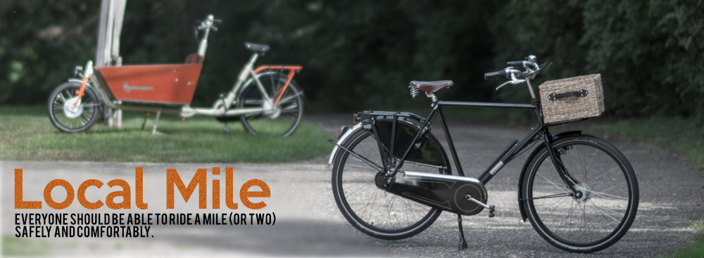
 That said, I will nearly always ride my bicycle for trips of one or two miles like to Festival Foods or Target which is a fairly safe and enjoyable ride from my house.
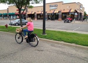
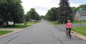
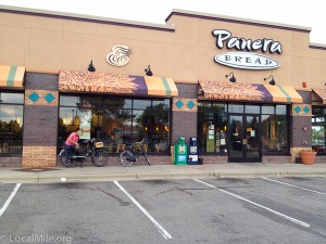 However, there are times when I quite enjoy riding in Vadnais Heights. Early on Saturday and Sunday mornings before there is much or any traffic on the roads is my favorite. I enjoy riding to Dunn Bros for a cappuccino or sometimes my wife and I will ride to Panera for breakfast. What’s great about our Dutch city bikes is that they’re easy to just hop on a go when we decide to do this.

